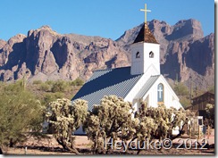
 Before leaving Arizona and the Phoenix area we wanted to do at least part of the drive known as the Apache Trail. Since we were staying on the Northeast side of Phoenix it only took a few minutes for us to travel to the town of Apache Junction where the Apache Trail begins.
We drove on U.S. 60 east to Apache Junction then on a bit further east until we encountered the cutoff for AZ 88. This was where we embarked upon the Apache Trail. It is said that the Apache Trail is one of the most scenic drives near the Phoenix area. This route is known for its incredible view of canyons, geologic 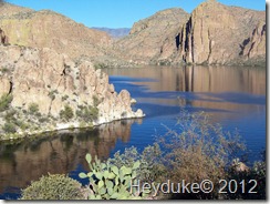 formations, desert flora and fauna, along with stunning lake views.
There are also quite a few old mining town tourist stops along this route that although looked somewhat interesting we didn’t stop to check them out. The road today is said to be in great shape when compared to 25 years ago. Treacherous is the adjective that was often used to describe the drive in the olden days and even today this drive is not one for nervous drivers nor for that matters their nervous passengers. The road twists and winds around tight blind turns making it difficult to look at all the beauty along the roadside and drive at the same time.
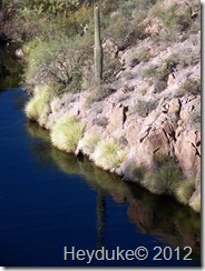 Fortunately there were several scenic stops all along the Apache Trail and even more rustic dirt pull outs where we could stop for a photo opportunity or to simply take it all in and enjoy the environs. Be careful because this is the last place one would want to have to get a tow truck.... like one poor guy we saw that was hitched up to a Sheriff’s vehicle to get a friendly tow out of a roadside ditch…
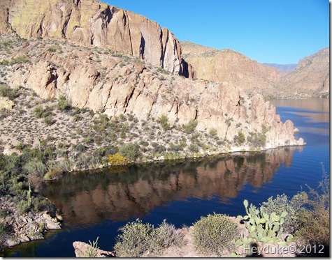
A bit further down the road we came upon an official scenic view turnout for Canyon Lake. Canyon Lake, a man-made reservoir lake, is very picturesque and as we got closer to the lake we stopped several times to take more pictures and simple admire its beauty. Only 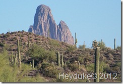 a couple of miles past Canyon Lake we arrived at Tortilla Flat, a town of only six inhabitants.We were going to stop at the saloon/restaurant for a cold beverage but the service was pretty slow and beverages pretty pricey.
We only went a little further down the road when we decided to turn around and return the way we came. A worthwhile drive and we wished we would have had more daylight so as to continue all the way to the town of Globe. In the end we 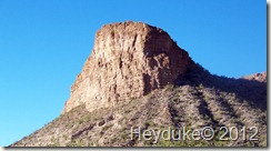 decided this was ok since we knew we would pass through Globe in the motorhome on our way to Deming, New Mexico.
The next morning we left Mesa, AZ around 9:45 and drove what I consider a real long day of 300 miles to Deming, NM. We chose a long day since we are trying to outrun a cold snap heading our way. We are camped at a Passport America park called El Rancho Lobo RV Park. A really inexpensive park at $10 per night (plus electricity) but it is off the beaten path and a drive on 2 miles of dirt road 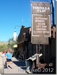 made it a bit of a hassle to get to. We decided it was good enough for one night but not much more.
We emailed the RV Crazy twosome whom we knew from reading their blog, are working on a Habitat for Humanity house in nearby Las Cruces. We asked for details as to where to pick up some green chilies and some good New Mexican food. Yep, Irma’s served up some fine New Mexican food, so we owe a big thanks to Catherine and Jo Beth. Happily we also found the brand of frozen green chilies they recommended! We head out on the road again this morning as we try to outrace the cold air heading south. The plan is to make another long drive to Alpine, TX where we will stay and let the cold front go on by us… unless it gets too cold :)

I agree in that the Apache Trail is very scenic with all the beautiful cactus. There are lots of places for great photos.
ReplyDeleteThe really treacherous portion started after Tortilla Flat. This is from my memory of driving this road 35 years ago, when that section was a dirt road, with a cliff on one side and a vertical wall on the other. If you continued on, you would have passed Apache Lake, and ended up at Roosevelt Lake, not Globe.
ReplyDeleteNW-Bound
I searched google map, and found that scary spot using google street view. It still looks the same, except that there was no side rail at all 35 years ago!
ReplyDeletehttp://goo.gl/maps/1IyEv
NW-Bound
you are correct we turned around just before the dirt road... wished we had more time to do it but there will always be another day
DeleteYou two are traveling in some very beautiful country. We had a wonderful time in Mesa, Apache Junction and Deming. Never been in Alpine, TX though.
ReplyDeleteSuch a beautiful are and great scenery, thanks for sharing.
ReplyDeleteI remember having to get the Dramamine out for the Apache Trail. Not sure we'll repeat that drive when we finally get out that way.
ReplyDelete